Fichier:Baton Rouge Louisiana waterfront aerial view.jpg
De Anekdotos
Taille de cet aperçu : 750 × 600 pixels. Autres résolutions : 300 × 240 pixels | 600 × 480 pixels | 960 × 768 pixels | 1 280 × 1 024 pixels | 1 500 × 1 200 pixels.
Fichier d’origine (1 500 × 1 200 pixels, taille du fichier : 1,04 Mio, type MIME : image/jpeg)
| Description |
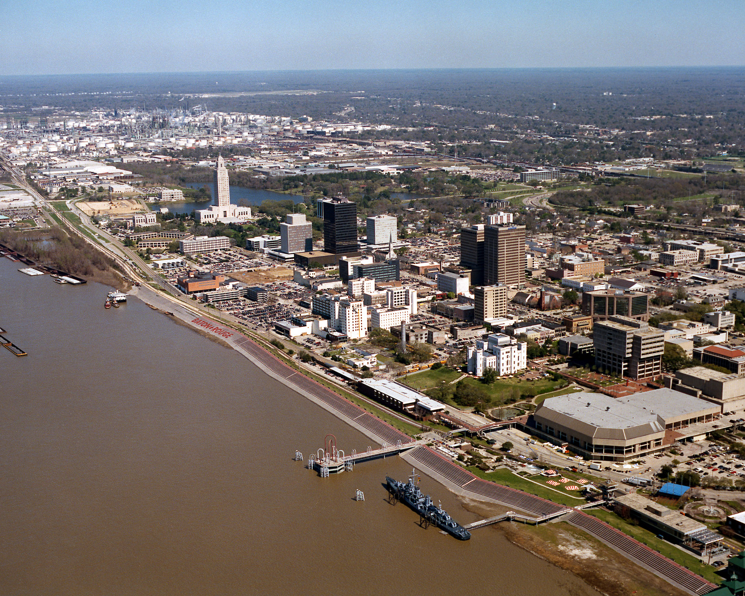
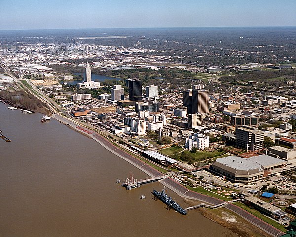
English: Aerial view of the riverfront area of Baton Rouge, Louisiana, USA. The city fronts on the Mississippi River in the center of Louisiana. The tall state capitol tower can be seen at center left. The historic destroyer USS Kidd is moored in the river at the bottom of the picture. View is to the north-northeast. |
|||
| Date | ||||
| Source |
U.S. Army Corps of Engineers Digital Visual Library Image page Image description page Digital Visual Library home page |
|||
| Auteur | Michael Maples, U.S. Army Corps of Engineers | |||
| Autorisation (Réutilisation de ce fichier) |
|
|||
| Lieu | Baton Rouge, Louisiana, USA |
| Lieu de la prise de vue | | Voir cet endroit et d’autres images sur : OpenStreetMap |
|---|
Historique du fichier
Cliquer sur une date et heure pour voir le fichier tel qu'il était à ce moment-là.
| Date et heure | Vignette | Dimensions | Utilisateur | Commentaire | |
|---|---|---|---|---|---|
| actuel | 6 avril 2007 à 05:05 | | 1 500 × 1 200 (1,04 Mio) | wikimediacommons>DanMS | {{Information | Description = {{en|Aerial view of the riverfront area of Baton Rouge, Louisiana, USA. The ctiy fronts on the Mississippi River in the center of Louisiana. The tall state capital tower can be seen at center left. The historic destroyer U |
Utilisation du fichier
La page suivante utilise ce fichier :